Weather HQ
Australia Weather Map
Toggle radar, observations, warnings and cyclone tracks on a single live map.
RAIN SINCE 9AM · mm
RAIN, RIVER, OBS & WARNINGS © BUREAU OF METEOROLOGY (INCL. WATER DATA ONLINE) · FOR EMERGENCIES CALL 000
Your Location
Local Conditions
National Warnings
Active Warnings
Tropical Cyclones
TC Activity
Climate Intelligence
Climate Drivers
Ocean climate snapshot
Local Forecast
Enter your postcode for a personalised 7-day forecast, AI summary, and nearby station history.
Your Location Forecast
Enter a 4-digit Australian postcode or use GPS to get your personalised daily forecast, including UV, rainfall, fire danger and an AI-written plain-English summary.
Climate Drivers
ENSO, IOD, SAM and MJO indices driving Australia's long-range weather patterns.
Madden–Julian Oscillation
RMM phase-space plot
Track runs oldest → newest; the dashed circle at radius 1 marks the weak/active threshold. Newest point highlighted.
Index history
Niño regions — weekly SST anomaly
Published records from NOAA CPC — the same figures quoted elsewhere, rather than our own computation, which would drift from them by whatever the method and baseline differ by.
Shaded above +0.8 and below -0.8, the conventional El Niño and La Niña thresholds.
Want the full 25-year record? It's available on The Front Line.
Sea Surface Temperature Anomalies
Australian / Western Pacific Region — Daily NOAA Coral Reef Watch 5km Analysis
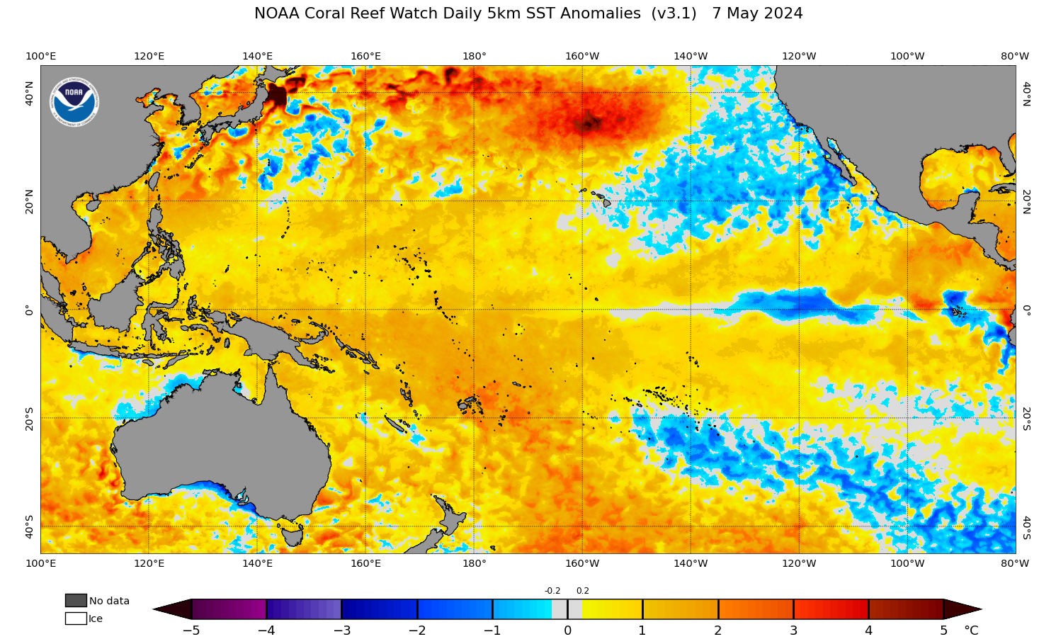
SST ANOMALY (°C)
Below-average SSTs suppress tropical convection and reduce cyclone potential. Cool anomalies in the Indian Ocean may indicate a developing positive IOD.
Sea surface temperatures close to the long-term average. Tropical weather activity is driven primarily by atmospheric patterns rather than oceanic forcing.
Elevated SSTs increase atmospheric instability and fuel tropical cyclone development. Areas of warm anomaly in the Coral Sea and Arafura Sea are high-risk zones during cyclone season.
SOURCE: NOAA CORAL REEF WATCH · 5KM DAILY SST ANOMALY · UPDATED DAILY
Satellite Imagery
Live looping imagery from the Himawari-9 geostationary satellite.
LOADING SATELLITE TILES...
DATA © JMA / RAMMB-CIRA SLIDER · HIMAWARI-9 · AUTO-REFRESHES EVERY 10 MIN · FULL VIEWER AT RAMMB-SLIDER.CIRA.COLOSTATE.EDU
Data © Bureau of Meteorology · Updates every 10 minutes · Visit bom.gov.au for official forecasts & warnings · For emergencies call 000